Hurricane Ian: 1.5 million properties at risk of flooding around Tampa Bay
Hurricane Ian continues to intensify rapidly, prompting multiple Watches and Warnings with significant wind, flood, and storm surge risks, and possible tornadoes.

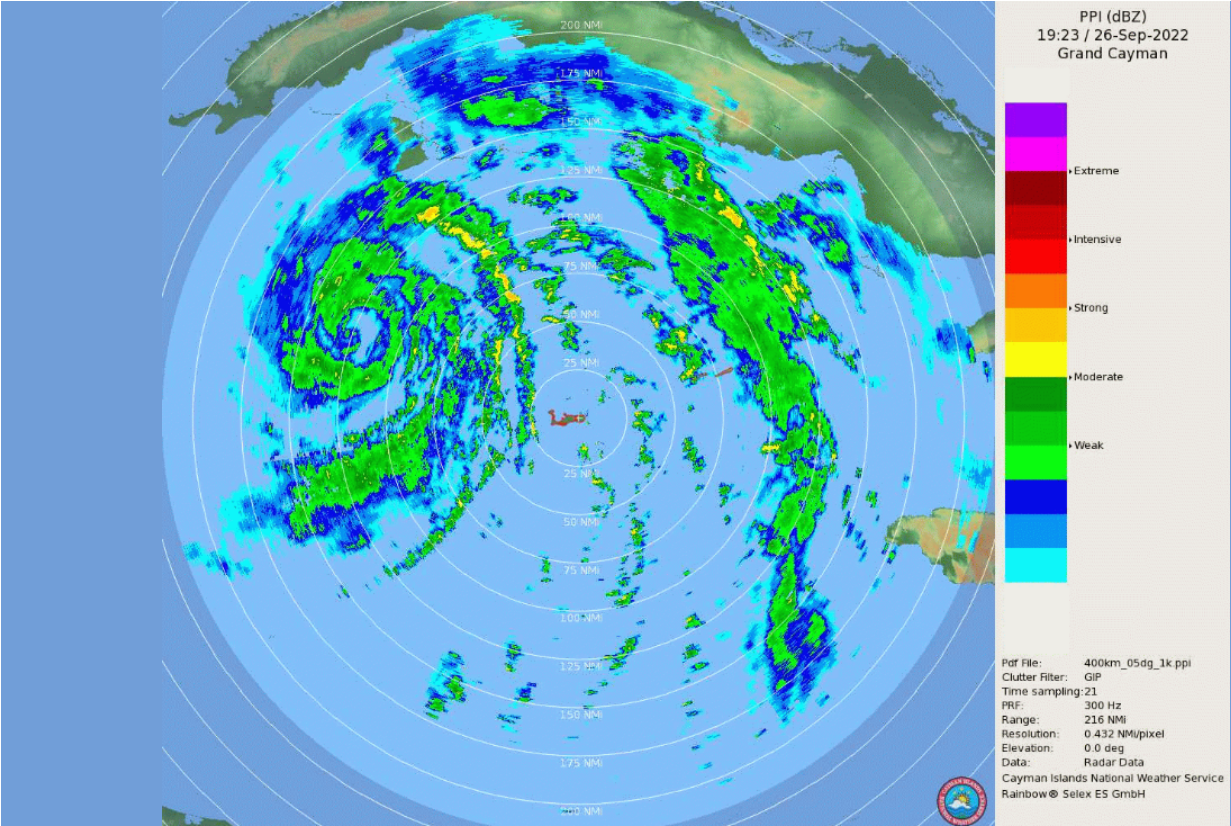
Florida's west coast is under a storm surge warning with danger of life-threatening conditions, especially from Fort Myers to the Tampa Bay region. By late Tuesday, tropical storm conditions are expected to arrive in Florida, with hurricane-force winds starting in west-central Florida on Wednesday morning.
Florida Keys and south Florida will experience heavy rainfall on Tuesday, spreading to central and northern Florida over Wednesday and Thursday. This can trigger flash, urban, and small stream flooding.
Central Florida may endure significant prolonged river flooding. Tornadoes are possible late on Monday and Tuesday across the Florida Keys and the southern/central Florida Peninsula.
The Southeast U.S. will face heavy rainfall Friday and Saturday. Central and northern Florida, southern Georgia, and coastal South Carolina should prepare for widespread considerable flash and urban flooding, and prolonged significant river flooding in the mid-to-late week.
Rainfall may provoke flash and urban flooding across the Florida Keys and the Florida peninsula through mid week.

How to find updated flood risk maps
At least 1.5 million properties are at risk of flooding in case of even a category 1 hurricane, according to the Tampa Bay Times. Some experts suggest the number could be much higher, as many flood threat maps are largely outdated.
An updated map of detailed flood risk areas for any location in the U.S. is available via the Augurisk Flood Risk Assessment. Log in or sign up to access the map.

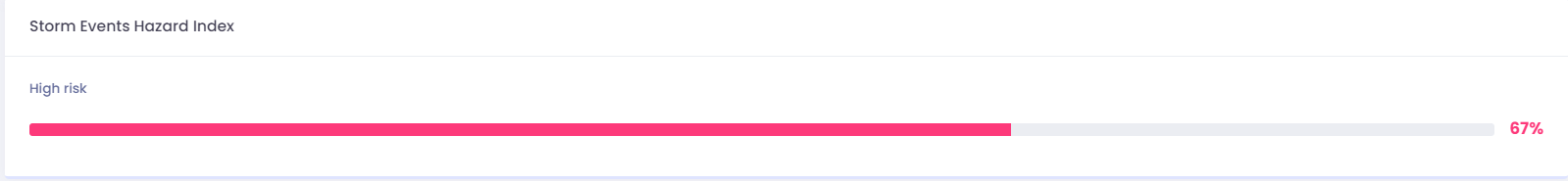
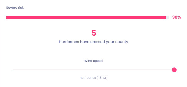
Generate a project for your address, and you will receive a risk score for storm events in your location, and see the number of hurricanes that have crossed your county.
Hurricanes
Check the number of reported tornadoes at the Fujita scale threshold that have crossed your county between 1960 and 2019.
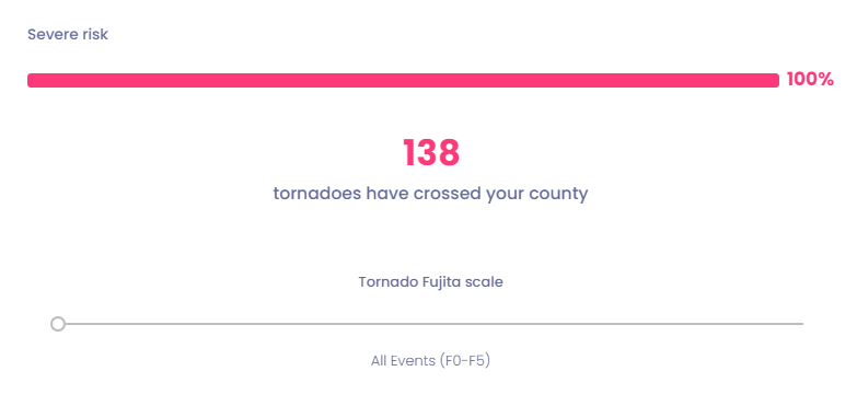
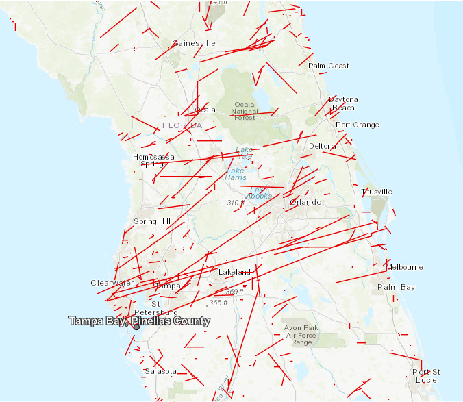
Review the historical tornado tracks around your property.
Watches and warnings
Watches and Warnings in effect as of 500 PM EDT...2100 UTC Mon Sep 26 2022 for the U.S. :
- A Hurricane Warning for Englewood to the Anclote River (including Tampa Bay) and Dry Tortugas.
In these areas, hurricane conditions are expected within 24 to 36 hours. Residents must complete all their vital preparations urgently to protect life and property.
- A Storm Surge Warning for Anclote River southward to Flamingo and Tampa Bay.
In these areas, there is a danger of life-threatening inundation due to rising water moving inland from the coastline during the next 36 hours.
- A Tropical Storm Warning for Lower Florida Keys from Seven Mile Bridge westward to Key West; Flamingo to Englewood.
In these areas, tropical storm conditions are expected within 36 hours.
- A Storm Surge Watch for Florida Keys from the Card Sound Bridge westward to Key West, Dry Tortugas, Florida Bay, Aucilla River to Anclote River, Altamaha Sound to Flagler/Volusia County Line, Saint Johns River.
In these areas, there is a possibility of life-threatening inundation from rising water moving inland from the coastline during the next 48 hours.
- A Hurricane Watch for North of Anclote River to the Suwannee River, Bonita Beach to Englewood.
In these areas, hurricane conditions are possible within the watch area, expected to start within 48 hours.
- A Tropical Storm Watch is in effect for Florida Keys, from Seven Mile Bridge to the Channel 5 Bridge, Lake Okeechobee, North of the Suwannee River to Indian Pass, Jupiter Inlet to Altamaha Sound.
In these areas, tropical storm conditions are possible within the watch area, generally within 48 hours.
Check the National Hurricane Center for further updates on the Watches and Warnings in your area.
If you have any questions, contact Augurisk. Stay safe!