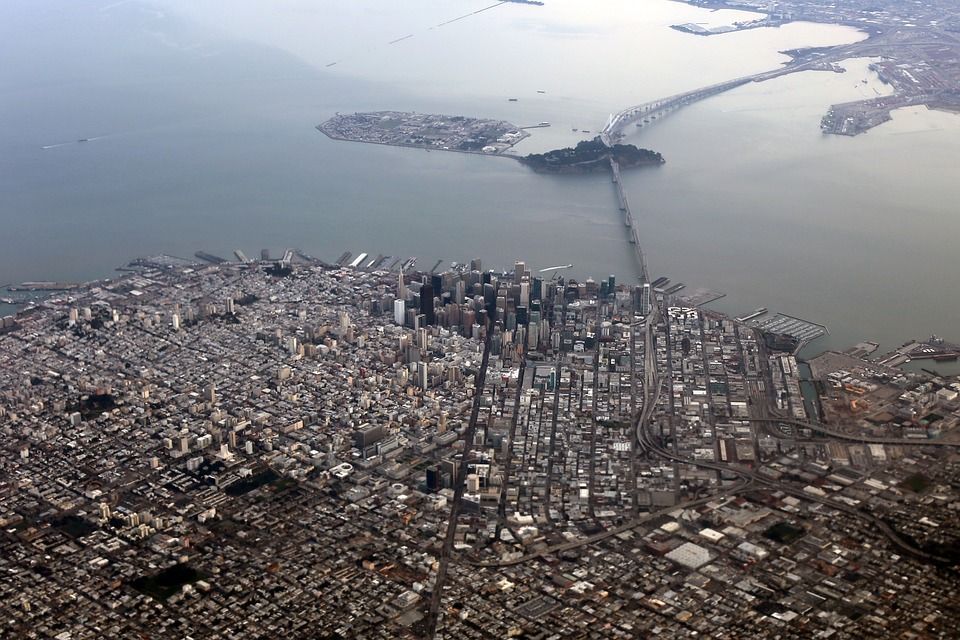
Unnerving Realities as San Francisco Bay Area Confronts the Swelling Seas
For the San Francisco Bay Area to adequately prepare for a future of swelling seas, a recent study recommends building sea walls and buffers as well as moving future developments away from ocean waters.

The economic impact of the coronavirus is disrupting climate change research and forcing new clean energy projects to be put on hold. Cities across the United States are making these decisions in a bid to free up funds to deal with the pandemic. San Francisco, one of the first cities shut down to slow the spread of the virus, finds itself in a bind.
The city has been forced to tackle one crisis at the expense of another. Currently, it is expecting a budget shortfall of up to $1.7 billion. The mayor has had to prioritize by putting a hold on all climate-related projects that have not yet started.
Projects such as the San Francisco sea wall that have already started have not been officially placed on hold. However, the shrinking tax revenues mean that the city’s finances are now under a huge strain as it battles to provide emergency services and housing for its population in these times.
Relegating climate-related infrastructure projects to the background gives cause for concern because the threat of climate change remains as potent as it was before the pandemic. Delaying or canceling infrastructure projects in the Bay Area could have far-reaching effects in the near future.
The Bay Area’s Struggle to Keep up with the Impacts of Climate Change
The Bay Area is already experiencing the effects of climate change. A UC Berkley research highlighted some of the effects that residents are already experiencing:
- The size of the Bay Area affected by "large fires" has increased substantially in the last 80 years.
- Storms like El Nino are driving unprecedented beach erosion due to more forceful waves, shifting currents, and sometimes, human infrastructure (such as dams) along the coast.
- The drought years of 2012-2016 led to the lowest moisture levels seen in the area in more than 1,000 years.
- The average temperature of the area has increased by 1.7°F since 1950.
- Sea level in the area has risen by 20cm (almost 8 inches) in the last 100 years.
- Record numbers of seals and sea lions washed up on beaches around the region in 2015.
The region is not ignoring the climate change conversation. There have been lots of collaborative efforts and comprehensive studies, and the citizenry has demonstrated a willingness to contribute to the fight through special taxes. However, some analysts believe that the Bay Area is still moving too slow overall to tackle climate change.
Over the years, the region’s decision-making process has metamorphosed into an extremely detailed one which means that very few things happen quickly in the area, including climate-change-related decisions. This has caused the region to be more reactive in its fight against the changing climate.
If the region is to be adequately prepared for the projected one-foot sea-level rise by 2050 or the nearly upper-level limit of around seven feet by 2100, it needs to respond with increased urgency.
New Insights on the Impact of Sea-level Rise on San Francisco Bay Area

A recent study has highlighted the impact of rising sea levels in California. It estimates that the region could see a half-foot increase in the levels by 2030, and as high as seven feet by 2100. These estimates could be worse depending on the severity of storms in the area around this period.
According to the study, locations along the coast and bayfront are going to see extreme floods during the period under review. This means the Foster City, the toll plaza for the Bay Bridge in Oakland, the Oakland International Airport, and Foster City are all at risk of going underwater.
To adequately prepare for a future with higher sea levels, the report recommends building sea walls, buffers, building properties with these new estimates in mind, and generally moving future developments away from the ocean waters.
Since the study was published, however, there’s been very little to suggest that the region is listening. The sea wall option is perhaps the one suggestion that the Bay Area has taken on board since. Unfortunately, even that looks likely to be shelved for a while as the region creaks under the impact of COVID-19.
Tens of Thousands of Bay Area Homes at Risk

According to a new analysis by Zillow and Climate Central published in 2019, thousands of homes in the Bay Area worth about $50billion are at risk of coastal flooding by 2050. If greenhouse emissions remain unchecked and the sea-level predictions become reality, these homes, some of which are highly coveted beach houses, will become swamped.
If nothing changes, the problem will get worse by 2100. By this point, more than 80,000 homes valued at nearly $100bn will be uninhabitable.
Models analyzing El Niño associated storms and annual peak tides, known as King Tides, have given scientists a glimpse of what we can expect in the area as sea levels rise and climate-change-induced storms become more frequent.
One of such research reports by scientists at the United States Geological Survey (USGS) using the FEMA’s Hazus model shows that the entire region is under significant risk. However, the lower-lying areas will suffer the bulk of the economic damages associated with loss of properties and infrastructure.
The research shows that the cost of replacing the structures and contents of homes and businesses that will be flooded in the event of a 1 meter (3.3 feet) sea-level rise, combined with a “100-year storm”, will amount to around $70 billion dollars. Even if the sea levels rise by 0.5 meters, the cost of replacement will still top $45 billion. With a 1.5 meters rise, the value will be $100 billion.
Some of the areas expected to be worst hit include Foster City, Redwood City, San Mateo, San Rafael, and Union City.
San Francisco Bay Area Is Also Sinking
The Bay Area isn’t just at risk of having properties and infrastructure wiped off by rising seas and frequent storms. The coastal land is also sinking due to a geological phenomenon known as subsidence; the sinking of the ground surface caused by either a movement of underground substances like oil, water, natural gas, and minerals, or natural events like soil compaction, sinkhole formation, earthquakes, erosion, and glacial isostatic adjustment.
With rising sea levels alone, models suggest that the region will lose at least 20 square miles of the coastal land to water by 2100. With sinking land, however, that minimum figure jumps 150% to 50 square miles lost at the very least. The worst-case scenario suggests that the region could lose 165 square miles.
Unfortunately, there is no permanent solution for subsidence. The only viable course of action, presently, is to reduce its effects by keeping the sea-levels from rising. This will require an unprecedented effort to cut back emissions.
New Plan to Combat Sea-level Rise

One of the biggest problems that plagued the Bay Area’s fight against climate change was the lack of a unified front amongst the counties and cities in the area on how best to proceed with the fight. A 2019 report, however, changed things for the better.
Scientists and planners spent two years creating the 250-page “San Francisco Shoreline Adaptation Atlas” which comprehensively covered the Bay’s 400-mile shoreline, dividing it into 30 zones. The report suggested solutions that will work best for each zone, taking into consideration the local conditions.
Some of the solutions include building more tidal wetlands, adding new beaches, constructing new levees, raising some structures, and building concrete sea walls. With this approach, the region can systematically tackle sea-level rise instead of adopting individualistic models that could improve the odds of dealing with sea-level rise for one county or city, but make it worse for the other.
The San Francisco Bay Conservation and Development Commission (BCDC) also launched the Adapting to Rising Tides (ART) Program designed to lead multi-sector and cross-jurisdictional projects that will ensure the region has a better understanding of the risks of sea-level rise and how to adapt to the challenges.
Although these solutions are laudable, there’s still widespread skepticism on how they will be implemented. It will almost certainly cost tens of billions of dollars for the San Francisco Shoreline Adaptation Atlas to be completed.
Presently, no one knows where the funds will come from. The Measure AA $12-per home annual parcel tax has raised around $500 million for wetland restoration and flood control projects, but that sum is only a fraction of what is needed.
Conclusion
San Francisco is currently between Scylla and Charybdis. It cannot afford to ignore the coronavirus pandemic, yet the devastating impact of sea-level rise looms large on the horizon. The Bay Area has to draft measures that will allow it to support the region through COVID-19, without losing sight of the big picture—the imminent threat of losing dozens of square miles to the seas.
Augurisk is a risk assessment platform for Climate change, Natural Hazards and Societal Risks. We help people and businesses assess climate risks associated with their properties, so they can better prepare for the future.